Fascinating story on the impact of technology, Google Maps in this case, on our lives. What happens when an online map doesn't match longstanding accepted borders? Do people take such maps that seriously? Apparently some do...
From UPI:
"Nicaragua, Costa Rica tense over Google map 'war'"
http://www.upi.com/Business_News/Security-Industry/2010/11/08/Nicaragua-Costa-Rica-tense-over-Google-map-war/UPI-49561289255748/
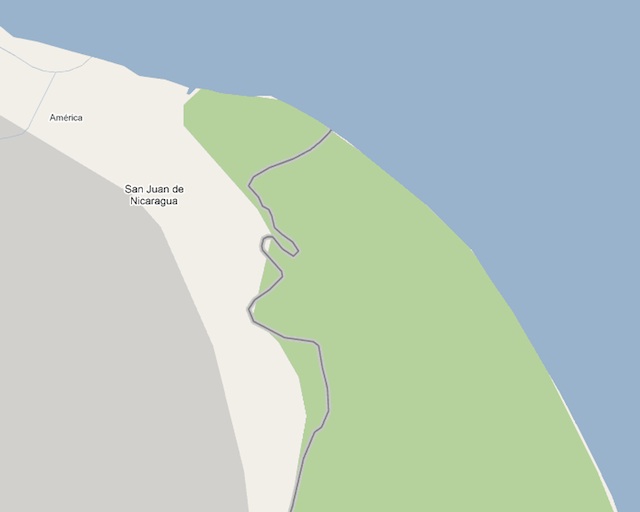
"SAN JOSE, Costa Rica, Nov. 8 (UPI) -- Costa Rica is recovering from the shock of a Nicaraguan border incursion over the small matter of a Google map misunderstood by the invaders.
"Or perhaps the matter wasn't small at all, as the online map showed Costa Rican territory as Nicaraguan but under Costa Rican control, triggering the conflict.
"Nicaraguan troops crossed into Costa Rica, took down the nation's flag and hoisted Nicaraguan flag -- all in response to the Internet map.
"It wasn't immediately clear why the invading Nicaraguan force used Google Maps as a guide -- the first time on record that source was used as such an authority -- to launch an attack that could have been averted by consulting with a military map."
Here is Google's official response. Note that they got their data from the U.S. State Department. From the Google Lat Long Blog:
"Regarding the boundary between Costa Rica and Nicaragua"
http://google-latlong.blogspot.com/2010/11/regarding-boundary-between-costa-rica.html
And a very detailed discussion of this issue, from Ogle Earth:
"About Costa Rica, Nicaragua, their mutual border, and Google"
http://ogleearth.com/2010/11/about-costa-rica-nicaragua-their-border-and-google/
Last, but not least, here is a link to Google Maps zoomed in on the border in question:
http://maps.google.com/?ie=UTF8&ll=10.919871,-83.67651&spn=0.060932,0.07596&z=14
View Larger Map

No comments:
Post a Comment